Travel in Iceland – Kirkjubæjarklaustur.
We, as a family have decided to spend some days camping in Kirkjubæjarklaustur, to explore the area of Skaftárhreppur. It is said that Kirkjubæjarklaustur is the centre of the South and if you want to encounter the earth, water, air and fire, you have arrived to the right place.
We stayed four nights in the camp site at Kirkjubæjarklaustur and it was definitely a surprise place to camp. The area is protected by woods from strong winds and secured by a gate and a ranger. It is large place! The grass fields is everywhere so not a big deal to set up your tent. The camp is equipped with electricity, hot water, shared kitchen facilities and warm showers (5 min cost 6x50kr). It includes also a laundry house. Wi-Fi is available and it is free of charge. There is playground for the little ones too.
While some of you have not had enough walks for the day you can climb up the mountain ridge set the foot of the camp site. There is a path to walk up and the view from the top is beautiful.
The opening hours are daily from 17:00 to 22:00 in the summer (June – September) and the phone is picked up outside the opening hours. The staff is very friendly and helpful and if you forgot a gas, they have some to sell.
It is also possible to download Locatify SmartGuide app to get a geology, landscaping and history trail of Kirkjubæjarklaustur and the surroundings.
Just about 20min drive from the camp, on the road nr. You can walk around the stunning and massive Fjaðrárgljúfur canyon. Fjaðrárgljúfur canyon was created by progressive erosion by flowing water from glaciers through the rocks over a long period of time, some say 9000 years ago. This magnificent canyon is placed at the foot of the Vatnajökull national park. It is about 2km long and 100m deep. The walking path has been made along one site of the top of the canyon with a few viewpoints. The walk will takes you up to 1 hours (forward and back) and it is easy. The canyon gained popularity after Justin Bieber featured it in his 2015 music video “I’ll Show You”. The number of visitors to the canyon has spiked since then. It accessible without a 4x4 and it is wise to check the information on the www.safetravel.is since the canyon may be closed from late September to early June due to the flora protection.
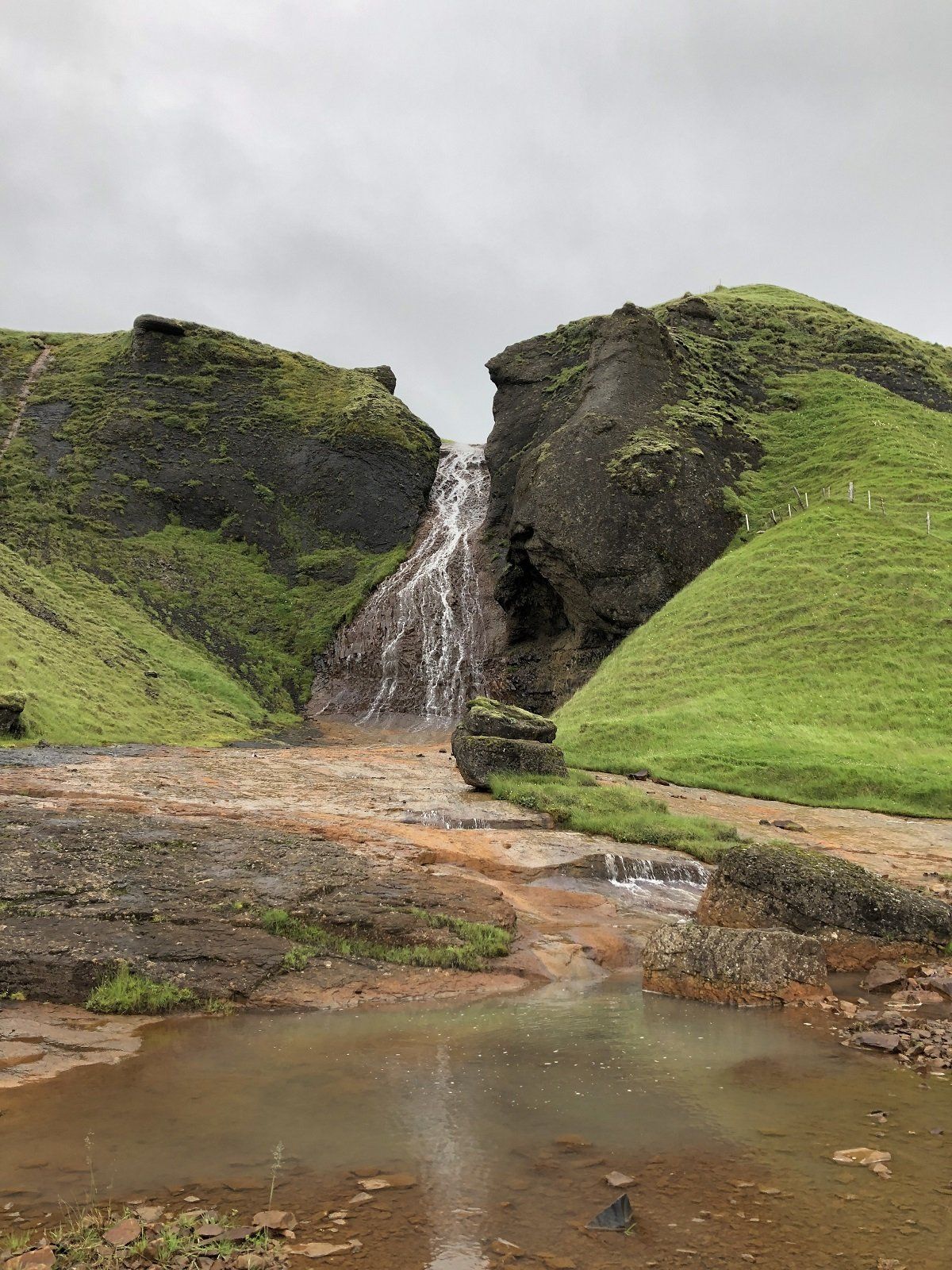
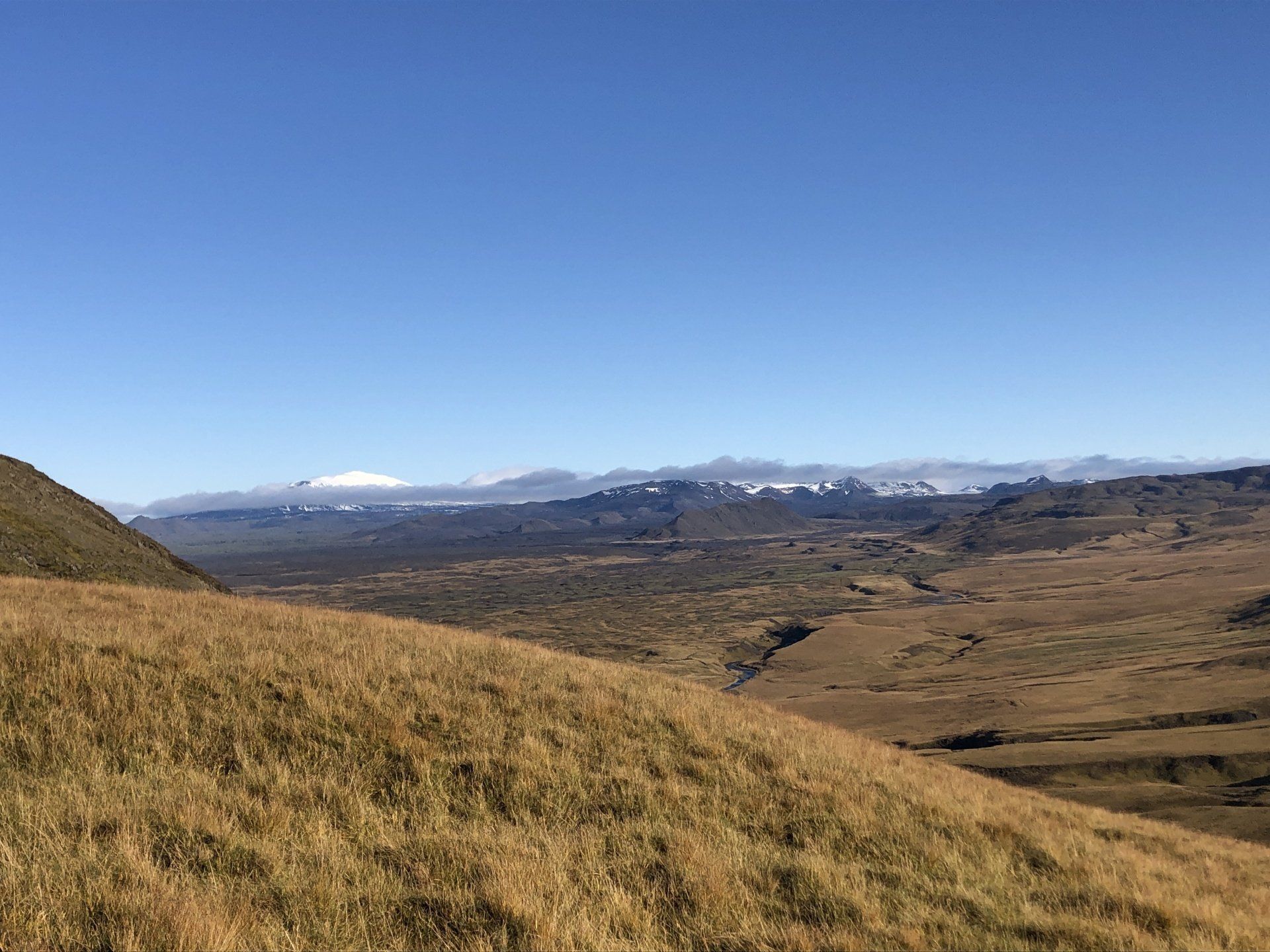
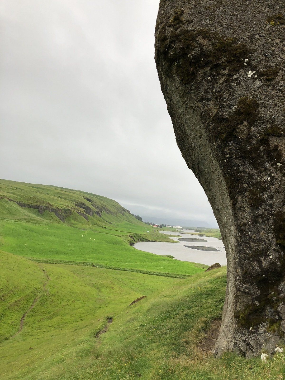
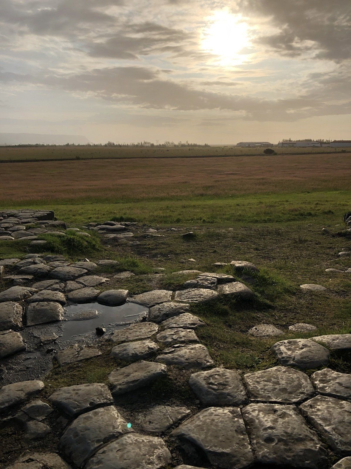
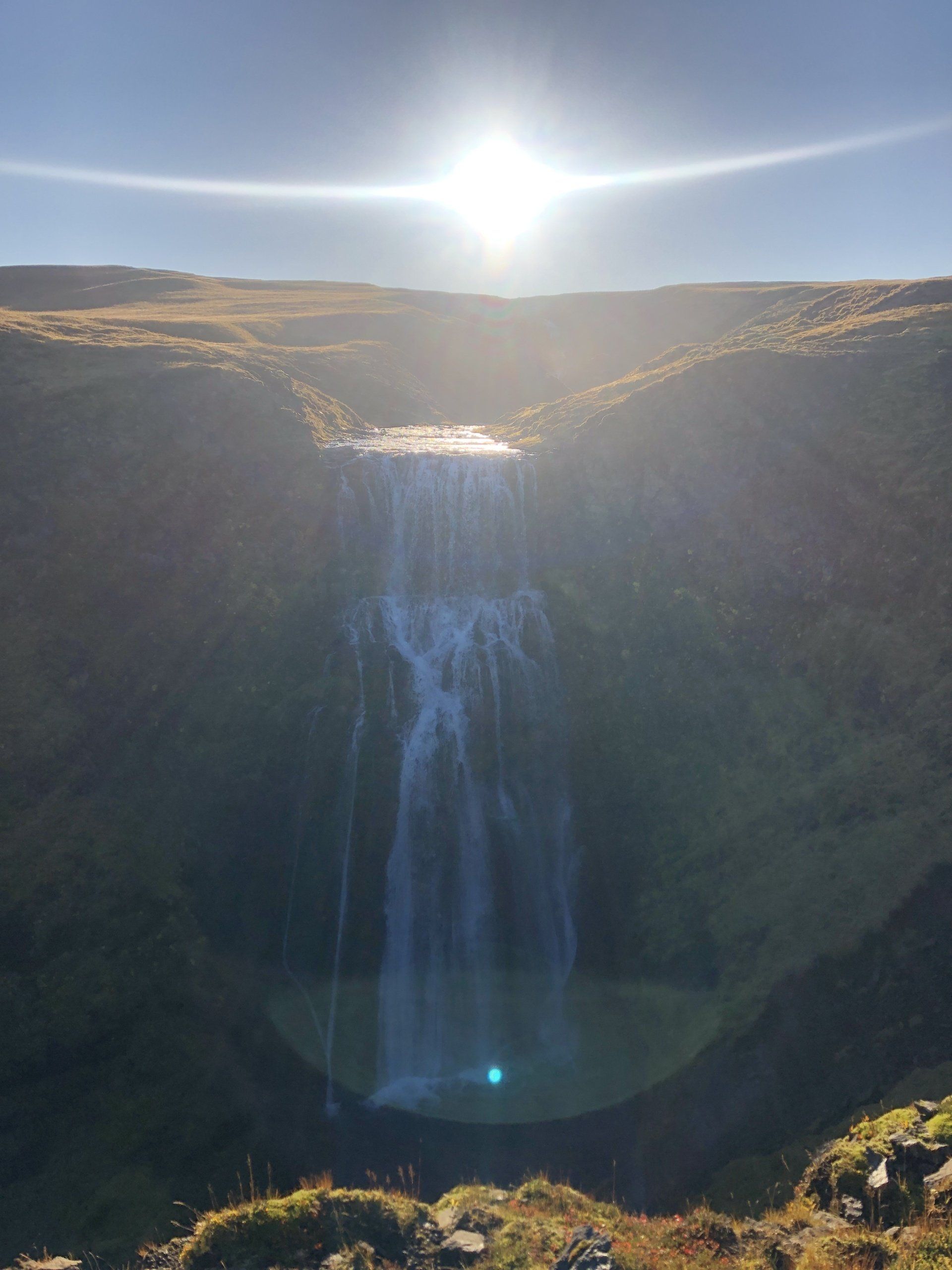
Skaftárhreppur has been shaped by fire, lava flow, wind and water and it is definitely one of the most scenery place to visit. Klaustur trail is the one to start with. It takes you to the geosites of Systrastapi (Sister´s Rock), Systravatn (Sister´s lake), Systrafoss (Sister´s waterfall) and the Kirkjugólfið (The Church Floor). The word „sisters“is used in many site names and that´s because Kirkjubæjarklaustur used to be a convent of Benedictine nuns from 1186 until the Reformation in 1550. Klaustur trail is about 7 – 8 hours to walk and you can start at few points and make it shorter. We started our walk by Systrafoss (Sister´s waterfall). The waterfall is surrounded by woods with several walking paths. You can find the highest tree in Iceland there! On the way you can find a cave where the sisters used to sing for the monks (sing a song there!) and the Sister´s lake (Systravatn). The sisters used to walk up there to bath. One story tells that once two sisters saw a hand raising up from the water holding a golden brush. When they tried to reach out the brush, no one saw them again. From the sisters´ lake you can continue on the top of the mountain ridge towards the east, walk down and look at the Church Floor on the way.
MTB bike in Iceland
A family run sheep farm started a new adventure few years ago. While chasing down the sheep from the summer pastures they always see the beauty of the paths the sheep has been walking for centuries. The stunning, unspoiled nature. They´ve got this idea to make it accessible on bikes and here they are today. They used MTB bikes from Specialized. So, when you cycle, you feel like you are flying, it is so natural, easy, steady and safe! You can bike endlessly in this unspoiled nature leaving no environmental foot marks as you are using the same paths as the sheep do! Believe me that the sheep know where to step with their feet.
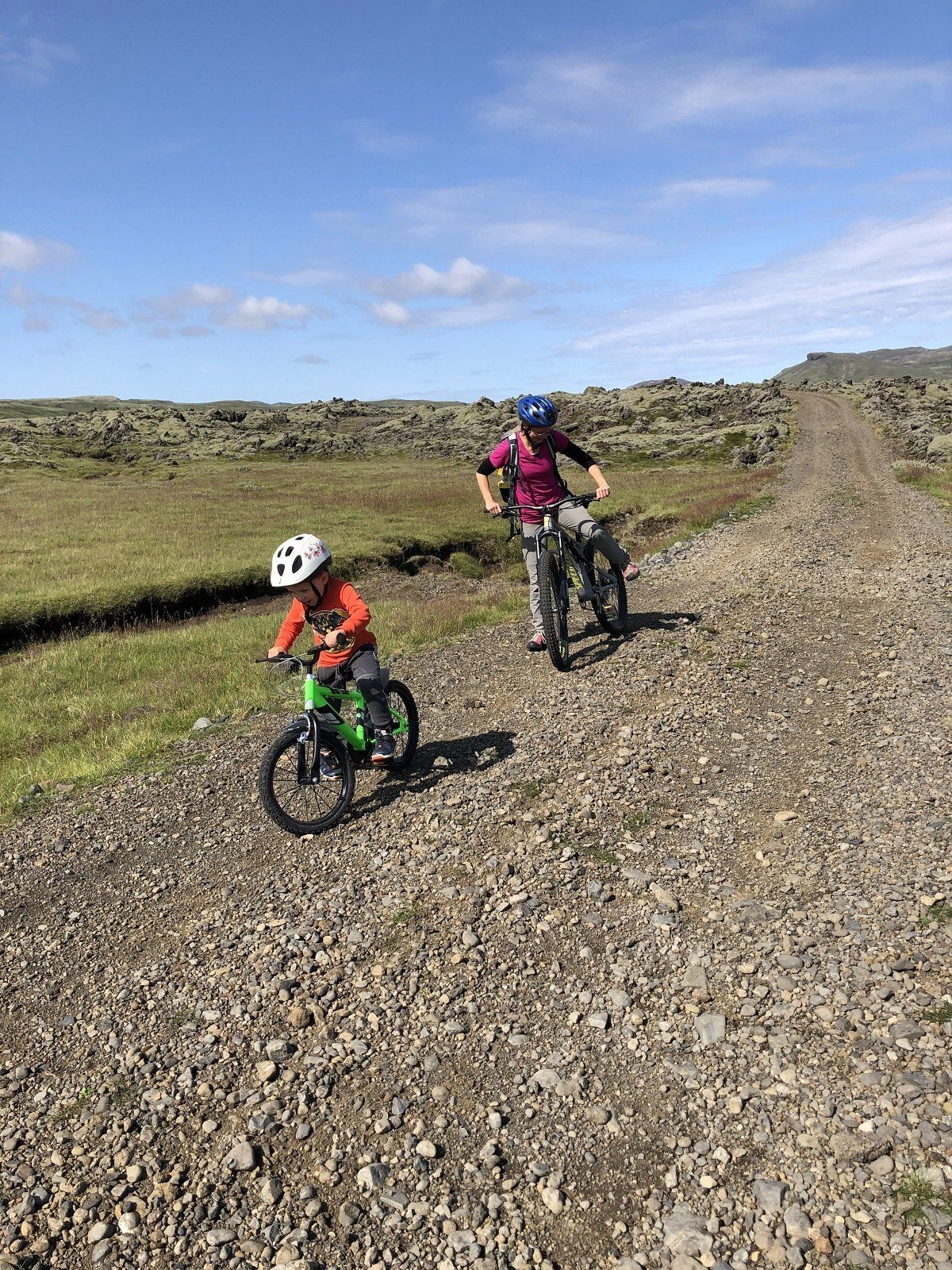
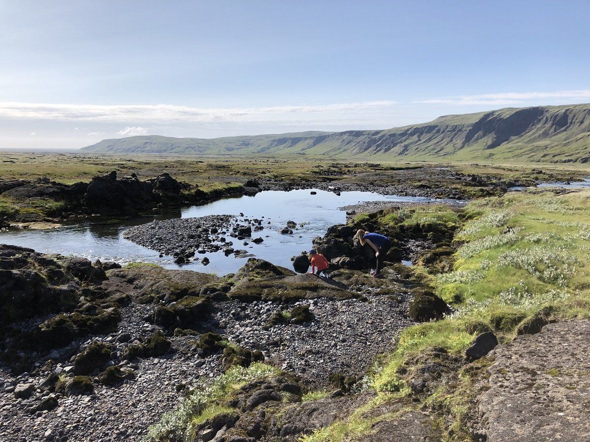
We are a family of three, including my four years old boy. We speak to the farm and they were happy to adjust the trip to our needs. We started with a jeep tour and head over on an off road towards to a cave in Laki (Skaftáreldar) lava fields. The cave is huge, you can feel the power of the lava flow there, find some ice and taste the purest water ever. After we explore the cave (which was easy for my boy too) we had a picnic outside with some hot chocolate and cookies. Then we were ready to bike! It was about 15km downslide and I just flew like a bird! It was not a problem for my boy to jump on and off the car, bike a while, explore the nature around, pick up some berries, drink from an icy cold river or look for fish in crystal clear water ponds hidden in the Laki lava fields.
Þríhyrningur
LOOKING FOR A DAY TRIP WITH SPECTACULAR VIEWS? GO FOR ÞRÍHYRNINGUR!
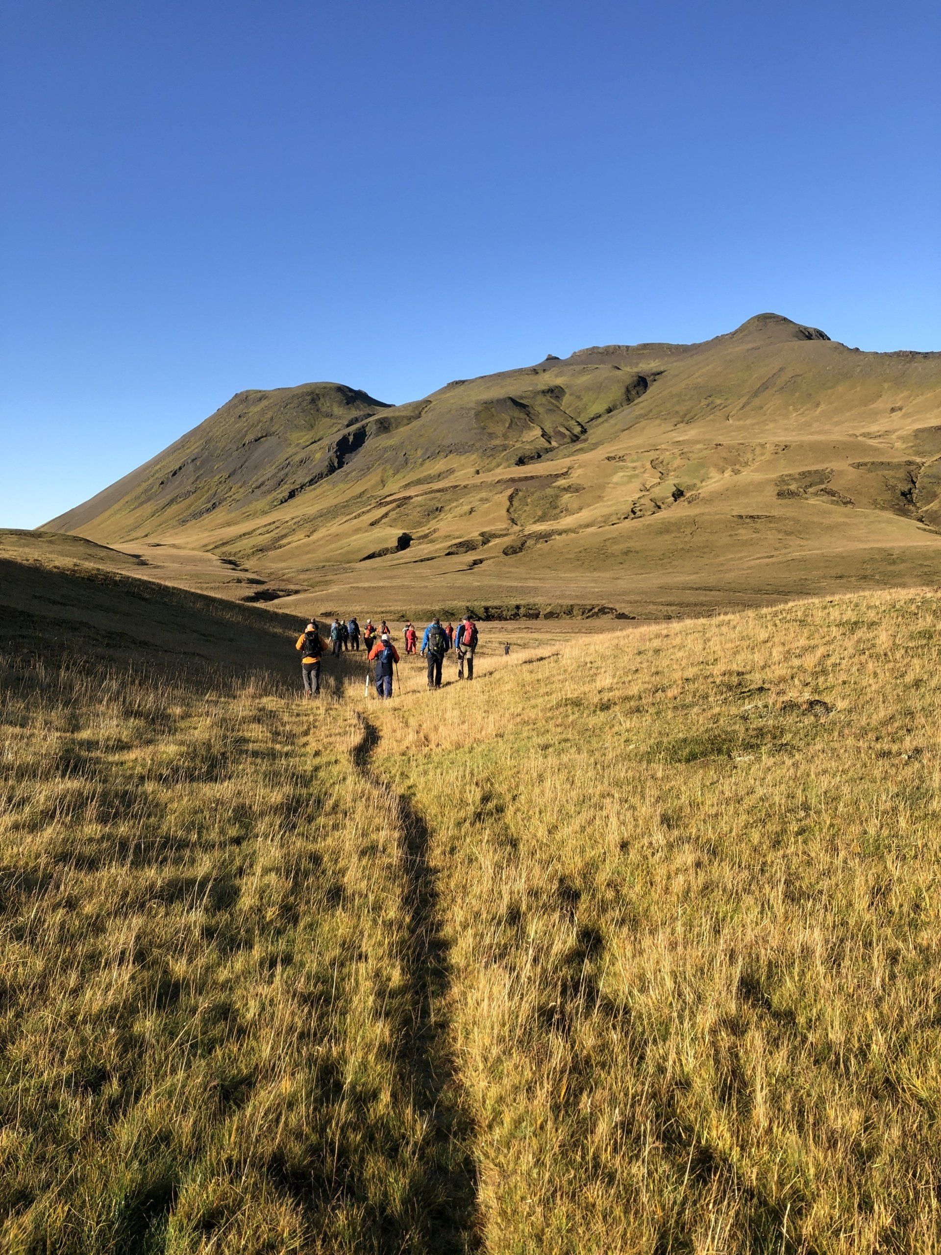
One day you finally make it! I´ve always been telling myself when looking at Þríhirnyngur mountain (that sits just behind the Húsid doorstep) that one day I will gain its summit (well, actually, its 3 summits). And today was the day. My young son and I joined a small walking group from „Ferðafélag Árnesinga“ and together we finally conquered Þríhirnyngur!
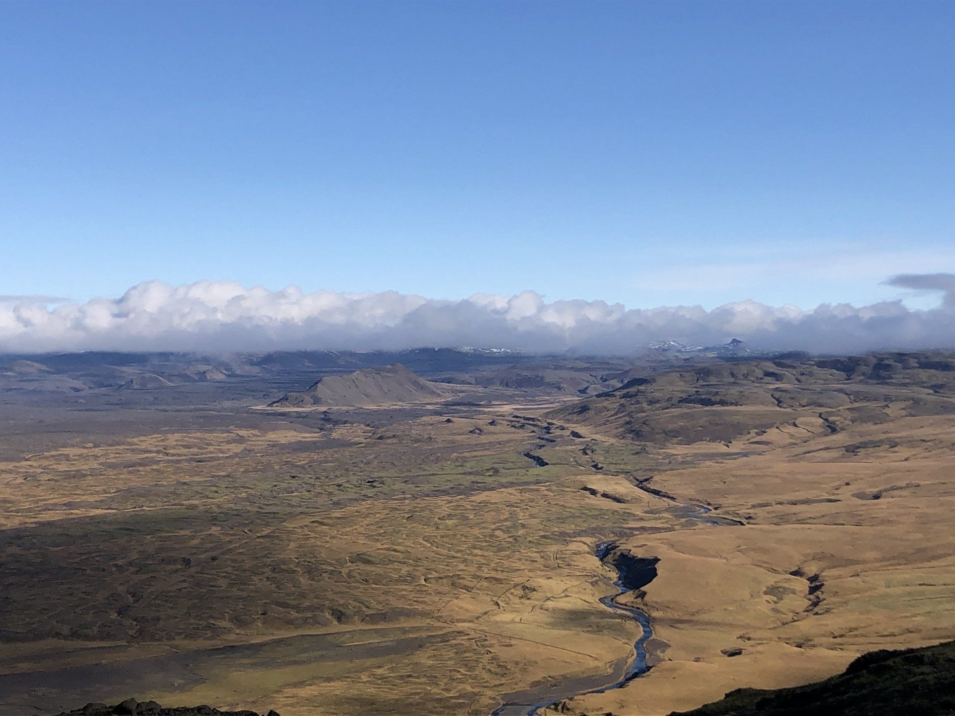
Þríhyrningur (Thríhyrningur), or ‘Three Peaks Mountain’, rises to 678m and its summit(s) gives a simply superb panoramic overview of this area of South Iceland; towards Hekla, Tindfjallajökull, Myrdalsjökull, Eyjafjalljökull and the Westman Islands.
The Þríhirnyngur trip taken contained a bonus too as we did not follow the usual, marked hiking trail which runs from the west part of the mountain. Instead we drove all the way around to the nort-west base of the mountain and our hike started to follow the „sheep“ path from the west. From there we followed the Þjófaá (Þjófa river) all the way to the little known (by tourists) „Þjófafoss“ (Þjófa waterfall). Þjófafoss is not as high and mighty as the popular Seljalandsfoss or Skógafoss but I would say that it is definitely more beautiful.
Downhearted, they descended from the mountain cave (possibly more slowly than when they had gone up!). As they walked downhill, the man felt his coat become increasingly heavy and, as he reached into his pockets, he found to his surprise that the leaves had turned to gold. Satisfied and happy with their eventual good fortune, the men did not, however, go back to collect the rest of the leaves ... as they felt and feared an eerie feeling surrounding this incident! We, sadly, found no treasure chest or leaves!
Following the river up stream from the waterfall you will soon find „Þjófahellir“ (Þjófa cave). It is still used a shelter for the summer grazing sheep in stormy weather. We could only fit three people into this cave. The cave is not marked in any way so you need to know where to look to find it 😊 .
There is some „story“ about this cave from the famous Njál’s Saga. According to the legend, there is a cave that is difficult to get to on the north side of the mountain. It was here that Flosi hid a treasure chest that was to be used as payment in a settlement in the event that he was caught by his enemies. Flosi and his men were never caught, however, so the chest was left in the cave. That was until some brave men decided to seek and fetch it. One „fortune seeker“ managed to find the cave but, as he looked into the chest, there were only dry leaves to be seen. Sadly, and with much disappointment, he did however fill his pockets with some of the leaves to show his companions.
From „Þjófahellir“ we turned northwards towards the looming Þríhirnyngur mountain itself. We followed only sheep paths. These sheep paths are very safe and reassuring; by using them you will definitely avoid muddy, wet areas and/or some unpassible cliffs/rock formation – sheep are wise!
The walk in by the waterfall and the cave was very much the easier part of the hike. After this the climb to the summit(s) of Þríhyrningur mountain truly started. First we climbed up to some meadow conditions and soon needed to climb through some rocky fields. The way to the top is not long but it is steep, so we took your time, taking several stops along the way.
You can walk all the way from Húsid to the summit of Þríhyrningur but, to shorten the walking distance, it is good to preferably have at least some „light“ jeep since you need to cross over the „Fiská“ (the Fisk river) to reach the walk‘s starting point as described above. The river is not deep but it is not passible for a normal car (and certainly not a rental car). From Húsid take road 261 to the Forestry Centre of Tumastaðir, drive on passed Tumastaðir and the Túnguskógar Forest, all the way to Vatnsdalur.